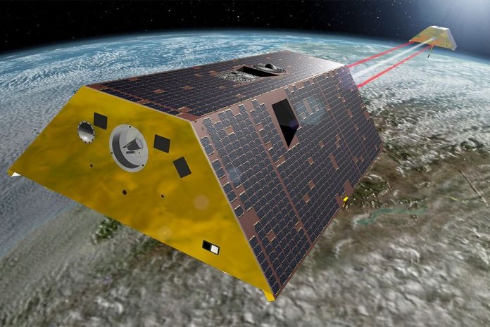
During testing, the gravity-measuring satellites, which will track the continuous movement of liquid water, ice and the solid Earth due to Earth’s changing seasons, weather and climate processes, earthquakes and even human activities, were subjected to conditions similar to those they will experience during launch and in low Earth orbit.
Both satellites, each weighing 600 kilograms, will be flown to the Vandenberg Air Force Base launch site in California in December to begin final launch preparations.
The project is a partnership between NASA’s Jet Propulsion Laboratory, located in Pasadena, California, together with the German Research Centre for Geosciences (GFZ, Potsdam). Both GRACE-FO research satellites will be launched into a polar orbit at an altitude of around 500km and at a distance of 220km apart. Both satellites will then take continuous, very precise measurements of the distance variations between each other and make monthly maps of the changes in Earth’s gravitational field, which are used to track the monthly movement of liquid water, ice and the solid Earth.
A Global Positioning System and a microwave ranging system measure the distance between the satellites to within a few microns and a sensitive accelerometer accounts for nongravitational effects, such as atmospheric drag and solar radiation. The GRACE-FO satellites will also feature an additional element: a new, more precise inter-satellite laser ranging instrument, developed by a German/American joint venture, which will be tested for use in future generations of gravitational research. Each satellite also makes up to 200 profiles of temperature distribution and water-vapour content in the atmosphere and the ionosphere on a daily basis to aid weather forecasting.
The German/American GRACE satellites, which have been in space since 2002, are the only satellites that have been capable of monitoring the transport of mass within the Earth system. These include changes in continental water distribution, the melting of polar ice masses or large inland glaciers, and mass redistributions following earthquakes. Data from the GRACE satellites are used to detect groundwater extractions, to monitor droughts and floods, to improve hydrological models, and to precisely quantify the contribution of land glacier and polar ice melt to sea level rise.
Long-duration data sets are vital to provide statistically significant information about climate changes and variations. The GRACE-FO mission will continue the important job started by GRACE and collect essential climate variables.


